

GPS Data
2.4.08 by EXA Tools (0 Reviews) November 18, 2023More About GPS Data
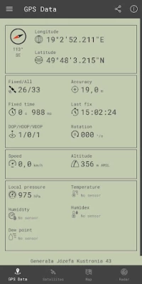
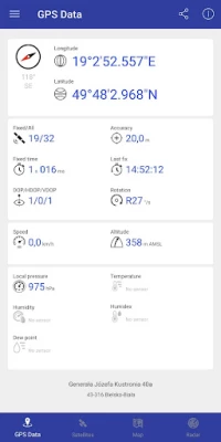
The app provides the user with the altitude and elevation, which are measures of the height of a point relative to some datum, usually sea level. It also provides the user with the location, which is given in terms of latitude and longitude, or GPS coordinates. The speed is given in either km/h or mph, and the quality of the GPS signal is also provided.
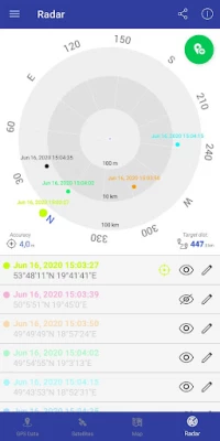
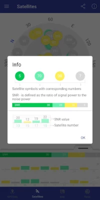
The list of GPS satellites is also given, with the number of satellites and PRN (pseudo random noise). Finally, the direction is given in terms of a compass, which helps to determine the geographical position.
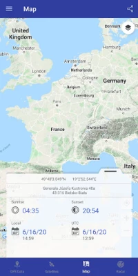
In addition to the above data, the app also provides the user with the sunrise and sunset time of the day, local UTC time, and position on the world map. This makes it a great tool for anyone who needs to know the data mentioned above.
Overall, this GPS data app is a great tool for anyone who needs to know the altitude, elevation, location, speed, quality of the GPS signal, and list of GPS satellites. It is a great alternative to navigation, GPS tracker, or GPS watch, as it provides all the necessary mobile data. With this app, you can have fun with GPS data!
Latest Version
2.4.08
November 18, 2023
EXA Tools
Tools
Android
1
Free
com.exatools.gpsdata
Report a Problem
Rate the App
User Reviews


Popular Apps


Editor's Choice